Scientists unveil global network of Important Sharks and Ray Areas
A landmark global report maps over 750 vital shark and ray habitats, revealing migration routes, breeding and feeding grounds across 70% of the ocean, giving governments powerful new science to guide conservation and climate-resilient ocean management.
A sweeping new global map of the ocean’s most important habitats for sharks and rays has been unveiled, offering the most detailed picture yet of where these threatened ocean travellers live, feed and migrate.
Released today by the IUCN Species Survival Commission (SSC) Shark Specialist Group, the Ocean Travellers Report identifies more than 750 Important Shark and Ray Areas (ISRAs) across the ocean, making it a landmark step forward for marine conservation.
Compiled by more than 1,330 scientists from over 100 countries, the report brings together decades of research to reveal critical breeding grounds, migratory corridors, feeding areas and aggregation hotspots across roughly 70% of the global ocean.
From coastal waters and continental shelves to remote seamounts and the high seas beyond national jurisdiction, the mapping effort highlights just how far and wide many shark and ray species travel – and how vulnerable their journeys have become.
The report is a collaborative effort that received support from the German Federal Ministry for the Environment, Nature Conservation, Climate Action and Nuclear Safety and the Convention on the Conservation of Migratory Species of Wild Animals (CMS).
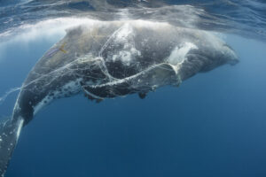
Sharks and rays are now the second most threatened group of vertebrates on Earth, with more than a third of all species facing extinction, driven by overfishing, habitat loss and the accelerating impacts of climate change.
The ISRA framework provides governments, regional bodies and ocean managers with a powerful new scientific tool to bring biodiversity into the heart of marine spatial planning, fisheries management, environmental assessments and area-based conservation.

In other news

While ISRAs themselves do not confer legal protection, they establish a globally consistent scientific foundation that countries can use to meet international commitments under CMS, the Sharks Memorandum of Understanding, the Kunming–Montreal Global Biodiversity Framework, and the UN Sustainable Development Goals.
Dr Rima Jabado, Deputy Chair of the IUCN SSC and Chair of the IUCN SSC Shark Specialist Group, said: “ISRAs spotlight the places where conservation action will have the greatest impact. This is the first time such a globally coordinated mapping effort has been undertaken for sharks and rays.
“It reveals, with unprecedented clarity, where species reproduce, feed, travel, and take refuge – and gives governments the science they need to safeguard these habitats before it is too late.”
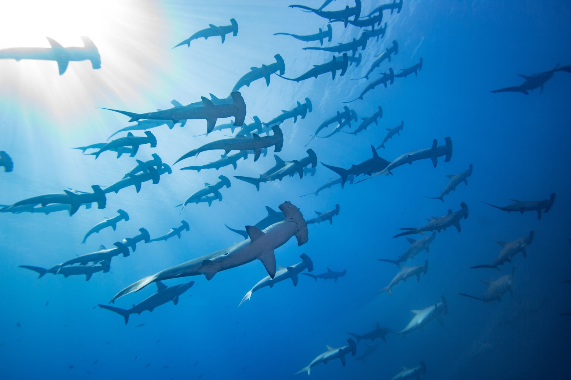
The report’s case studies paint a vivid picture of the ocean’s hidden connectivity: migratory corridors stretching between South Africa and Mozambique; productivity-rich upwelling systems in the Eastern Tropical Pacific; culturally important shark and ray aggregations in the Pacific Islands; and distinctive movement patterns in far-flung archipelagos such as French Polynesia.
Yet many of these vital habitats overlap with some of the ocean’s busiest and most heavily exploited regions, including industrial fishing grounds, shipping lanes and offshore development zones. The findings underscore the urgent need to align ocean-use decisions with the best available biodiversity science.
Amy Frankel, Executive Secretary of the Convention on Migratory Species (CMS), a legally binding treaty of the United Nations, noted that: “Migratory sharks and rays depend on healthy, connected ocean habitats. ISRAs give governments and stakeholders a powerful tool: a clear map of important habitats, conservation of which international collaboration is essential. This work strengthens the scientific backbone of CMS and will help governments translate commitments into concrete actions both within national waters and on the high seas.”
Climate change is adding another layer of urgency. As ocean temperatures rise, currents shift and migration cues are disrupted, many species are being pushed into new areas, sometimes with little protection. The report highlights how ISRAs can also help identify future refuges and resilience hotspots, supporting climate-adapted conservation strategies.
All of the mapped areas are now freely available through the ISRA e-Atlas, an interactive online platform designed to make the data accessible to policymakers, scientists, journalists and the wider public.


"*" indicates required fields
Printed editions
Current issue
Back issues
Enjoy so much more from Oceanographic Magazine by becoming a subscriber.
A range of subscription options are available.