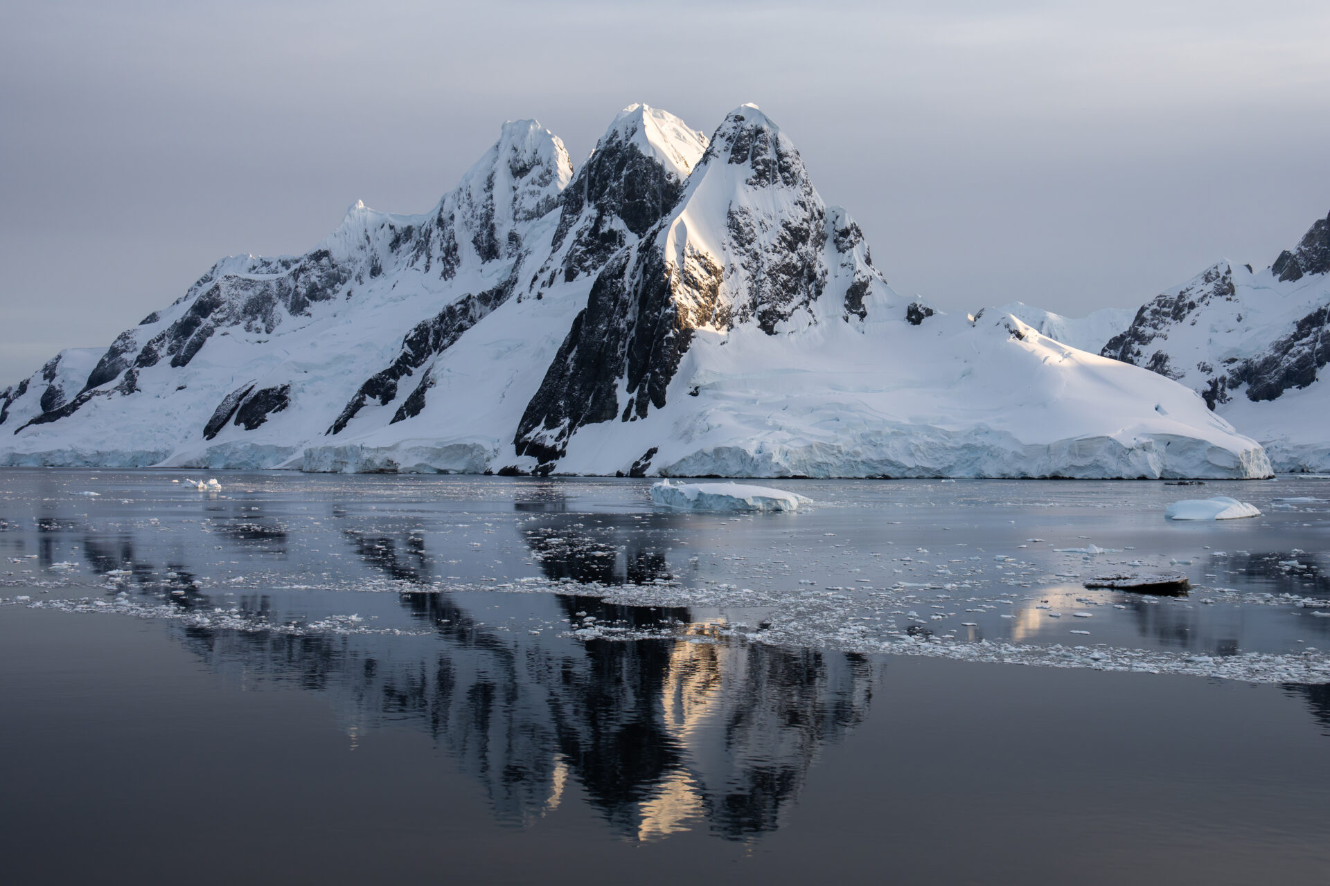
Antarctica lost 10 times Greater Los Angeles in ice over 30 years
A 30-year satellite analysis reveals Antarctica has lost 12,820 square kilometres of grounded ice, with concentrated retreat in West Antarctica, providing a critical benchmark for future sea-level rise projections.
Antarctica has lost almost 13,000-square-kilometres of grounded ice over the past three decades — an area equal to nearly 10 times the size of Greater Los Angeles — as key sectors of the continent’s coastline quietly retreat under mounting ocean pressure.
It’s the headline figure to have emerged from a comprehensive 30-year satellite analysis led by glaciologists at the University of California, Irvine, who have produced – for the first time – a circumpolar map of Antarctic grounding line migration.
The grounding line — or in layman’s terms the point at which the ice sheet lifts off bedrock and begins to float — is one of the most critical indicators of long-term ice sheet stability and future sea-level rise.
The study, published in Proceedings of the National Academy of Sciences, shows that while 77% of Antarctica’s coastline has remained stable since 1996, concentrated losses in West Antarctica, the Antarctic Peninsula and parts of East Antarctica have driven a steady net retreat. On average, 442-square-kilometres of grounded ice have been lost each year.
“The grounding line is where continental ice meets the ocean, and measuring the movement of grounding lines with satellite-based synthetic aperture radar has been our gold standard for documenting ice sheet stability,” said lead author Eric Rignot, UC Irvine Distinguished Professor and Donald Bren Professor of Earth system science.
“We’ve known it’s critically important for 30 years, but this is the first time we’ve mapped it comprehensively across all of Antarctica over such a long time span.”
The most dramatic changes were recorded in West Antarctica’s Amundsen Sea and Getz sectors. Pine Island Glacier retreated 33 kilometres, Thwaites Glacier 26 kilometres, and Smith Glacier an extraordinary 42 kilometres from their 1996 grounding line positions.
“Where warm ocean water is pushed by winds to reach glaciers, that’s where we see the big wounds in Antarctica,” explained Rignot, who is also a senior research scientist at NASA Jet Propulsion Laboratory. “It’s like the balloon that’s not punctured everywhere, but where it is punctured, it’s punctured deep.”

In other news


To build the 30-year record, the team synthesised data from multiple international satellite missions, including platforms operated by the European Space Agency, alongside Canadian, Japanese, Italian, German and Argentine systems. The project also marks a milestone for NASA’s Commercial Satellite Data Acquisition programme.
According to co-author Bernd Scheuchl, the research represents the first major polar success built on commercial synthetic aperture radar data. Contributions from companies such as Airbus U.S., ICEYE US and Finland’s ICEYE Ltd. allowed scientists to augment long-term agency missions with near-daily observations in critical regions.
“This work shows how commercial SAR data can be used to contribute to the virtual SAR constellation by augmenting the program of record from agency-run missions,” Scheuchl said. “The ability to access daily observations in critical areas using commercial assets, combined with decades of international space agency data with large-area coverage, has opened a new era in polar monitoring.”
While much of the retreat can be attributed to warm ocean water intruding beneath the ice sheet, researchers remain puzzled by substantial grounding line migration along the northeast Antarctic Peninsula, where no clear evidence of ocean-driven melting has been found.
“A lot of these places have warm ocean water in proximity, but on the east coast of the peninsula, there’s substantial retreat, and we don’t have evidence for warm water,” Rignot said. “Something else is acting – it’s still a question mark.”
Beyond documenting ice loss, the 30-year dataset provides a crucial benchmark for next-generation ice sheet models used to forecast future sea-level rise.
“Models have to demonstrate they can match this 30-year record to claim credibility for their projections,” Rignot noted. “That’s the real value of this observational record: knowing that this grounding line migration has happened. If a model can’t reproduce this record, the modeling team will need to go back to the drawing board and figure out what boundary condition or physics are missing.”
For now, the researchers highlight that more than three-quarters of Antarctica’s coastline remains in a ‘stable’ condition, but issue the stark warning that further sea ice cover loss could well “be the next step” without appropriate action taken.


"*" indicates required fields
Printed editions
Current issue
Back issues


Enjoy so much more from Oceanographic Magazine by becoming a subscriber.
A range of subscription options are available.