Scientists unite to map and protect Atlantic’s deep-sea corals
Scientists from nine countries launch Coral Cartography, using imagery and machine learning to map Atlantic cold-water corals, fill data gaps, and support conservation and policy protection of vulnerable deep-sea ecosystems.
An international team of scientists has launched an ambitious Atlantic-wide coral mapping project to fill critical gaps in our understanding of cold-water coral, identify vulnerable regions of the Atlantic, and then translate all those findings into policy that will protect and restore them.
Called Coral Cartography: Mapping Atlantic Cold-Water Corals to Support Area-Based Management, the initiative – bringing together researchers from Norway, the UK, Portugal, Germany, Mauritania, Namibia, South Africa, Uruguay, and Brazil – was unveiled at the All-Atlantic Ocean Research and Innovation Alliance Forum 2026 — a flagship gathering of the Atlantic scientific community.
Funded through the Coral Research and Development Accelerator Platform, a G20 initiative established in 2020 to accelerate solutions for coral reef protection, the project brings together experts from nine Atlantic nations. Spanning disciplines including image-based survey, coral taxonomy, habitat mapping, management, and policy engagement.
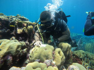
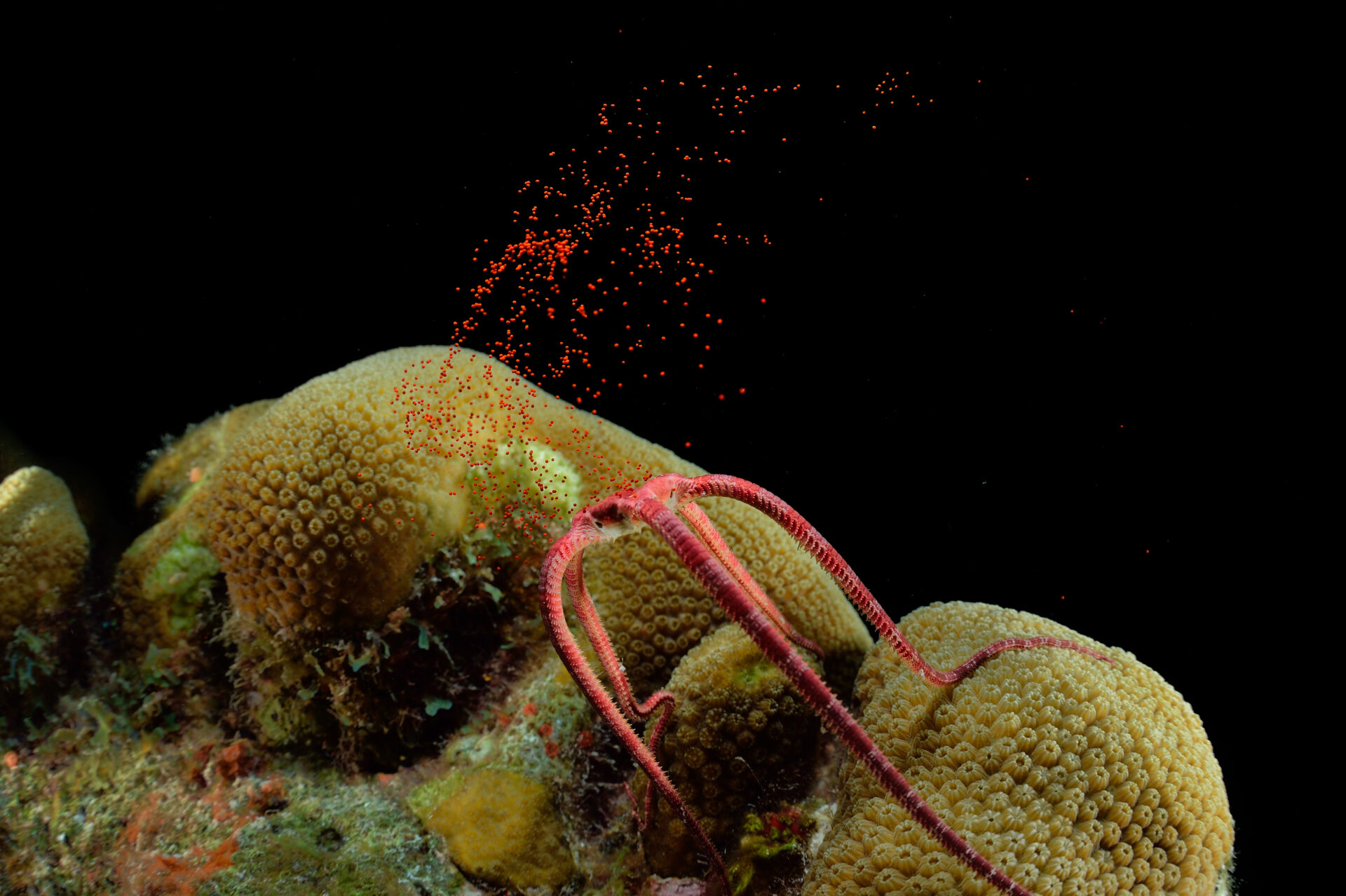
Cold-water corals are a vital component of deep-sea ecosystems, yet face mounting pressures from fishing activity, emerging deep-sea mining interests, and climate change. While parts of the North Atlantic are relatively well studied, significant knowledge gaps persist across the Central and South Atlantic.
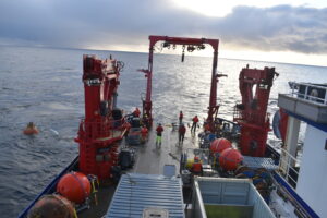
Coral Cartography aims to address this imbalance by unlocking extensive archives of previously unanalysed imagery, including material collected through the EAF Nansen Programme along the West African margin. These datasets will be combined with new survey data, including expeditions planned off Brazil later this year, to build the first basin-wide picture of cold-water coral habitats.
Dr Ana Hilário, co-lead of the Challenger 150 Programme, said: “In the North Atlantic, we have accumulated big volumes of deep-sea video and imagery over the past two decades, but most of it remains unanalysed because manual interpretation is so time-consuming.
“By unlocking these archives, we can significantly accelerate our understanding of the deep-sea and develop robust species distribution models to predict their occurrence under current and future climate conditions, helping to guide the protection of these vulnerable ecosystems.”

In other news
The project will produce a standardised dataset on coral distribution and density across explored regions of the Atlantic. These data will then be used to train machine-learning models capable of predicting coral occurrence in unsurveyed areas, enabling researchers to fill critical gaps in understanding.
Ultimately, the team hopes to generate detailed maps of cold-water coral distribution, density, and diversity under both present-day and future climate scenarios. These outputs are expected to support the identification of vulnerable areas and candidate sites for protection, both within national Exclusive Economic Zones and in international waters.
A central objective is to ensure that findings are translated into policy. Results will be communicated directly to key international bodies, including Regional Fisheries Management Organisations, the International Seabed Authority, the Convention on Biological Diversity, and OSPAR Commission, as well as national governments, with the aim of strengthening legal protections for deep-sea coral ecosystems.
The project also places strong emphasis on training early-career scientists and building long-term collaborative networks across the Atlantic region.
The initiative is led by Plymouth Marine Laboratory in partnership with 11 institutions. Professor Kerry Howell, project lead and co-lead of the Challenger 150 Programme, said: “Cold-water corals support some of the most remarkable ecosystems in the deep ocean, yet vast stretches of the Atlantic remain unmapped and unprotected.
“By bringing together previously inaccessible data, machine-learning, and an internationally connected team of experts, this project will give decision-makers the evidence they need to protect these fragile habitats – now and as our ocean changes. Critically, we will be building the scientific capacity essential for the long-term stewardship of the Atlantic.”
Dr Lara Atkinson of the South African Environmental Observation Network, added: “Forging collaborations within a growing international network of deep-sea researchers unlocks opportunities for countries like South Africa, simultaneously elevating the scope and quality of our national research and expanding the scale at which we can advance knowledge of our deep-sea ecosystems.
“Projects like Coral Cartography are initiatives that enable us to provide more accurate, actionable information on the critical areas that require management interventions. Showcasing South Africa’s progress in deep-sea research and exchanging knowledge with others through platforms like AAORIA, means our collective research becomes far greater than the sum of its individual parts, and this amplification is what we need to achieve the ocean we want.”
The project is being formally launched in Salvador, Bahia, at the AAORIA Forum, hosted by Brazil’s Ministry of Science, Technology and Innovation.
The gathering advances the All-Atlantic Declaration, signed in 2022 by countries including Argentina, Brazil, Cabo Verde, Canada, Morocco, South Africa, the United States, and the European Union, and aims to strengthen international cooperation in ocean science and governance.


"*" indicates required fields
Printed editions
Current issue
Back issues
Enjoy so much more from Oceanographic Magazine by becoming a subscriber.
A range of subscription options are available.