Researchers map ancient world beneath southern Barrier Reef
Scientists and Indigenous Rangers have mapped a submerged ancient landscape beneath the southern Great Barrier Reef - revealing the coastline where First Nations people lived before rising seas inundated the region 7,000 years ago.
A 24-day research voyage to the southern Great Barrier Reef has returned bearing maps of ancient coastal landscape – inclusive of rivers, lakes, estuaries, and beaches – lying submerged beneath the ocean and thought once to be home to First Nations people thousands of years before rising sea levels covered it.
Led by the University of Queensland aboard CSIRO’s research vessel, RV Investigator, the voyage was co-designed with the Darumbal Traditional Owners of Sea Country and the neighbouring Woppaburra people, whose cultural knowledge and songlines were woven into the research from the outset.
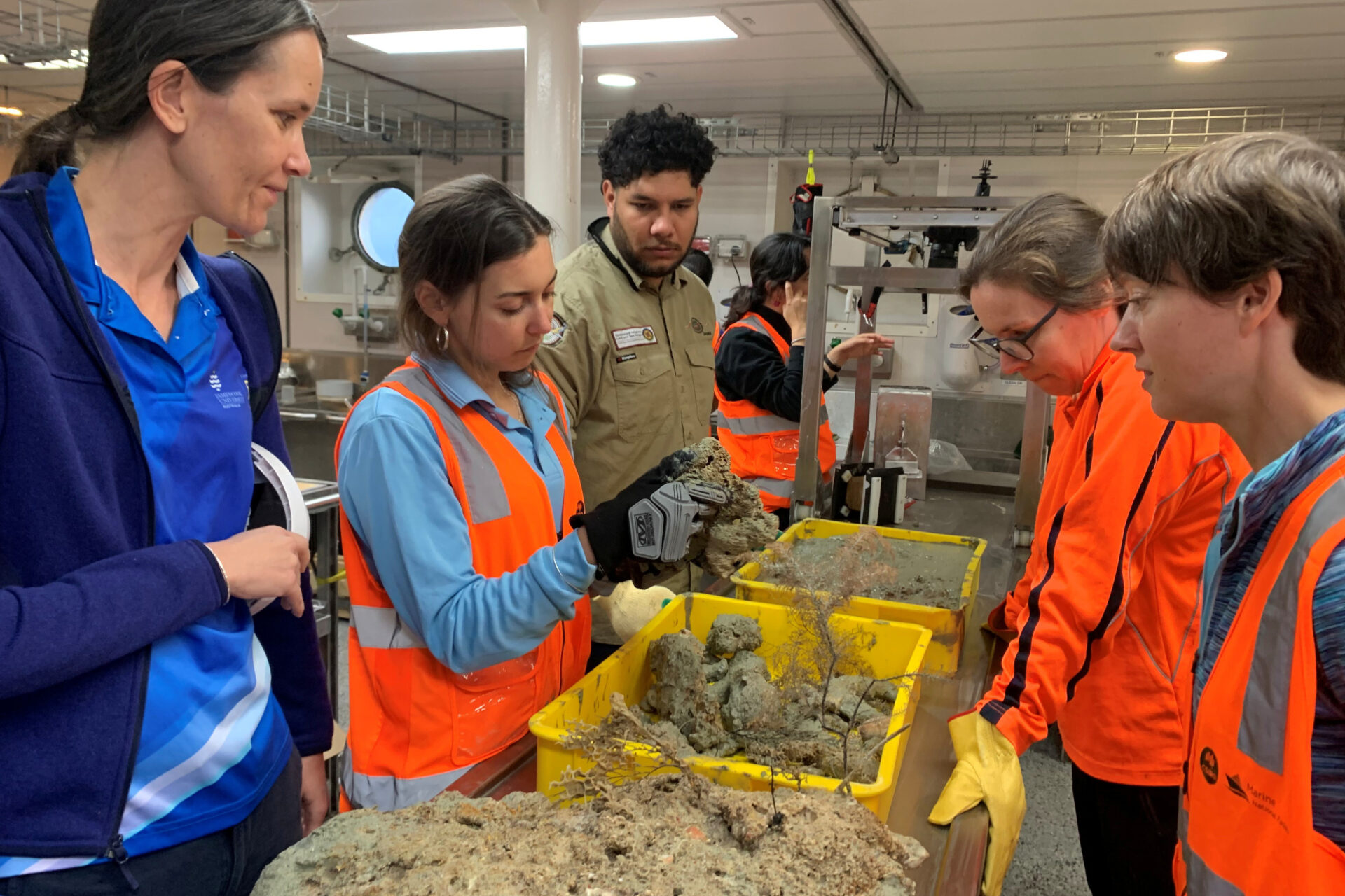
Land and Sea Country Rangers from both groups sailed with the scientific team, working alongside researchers to connect what the sonar revealed on the seafloor with what their communities have always known about the country beneath the water.
“First Nation people arrived in Australia over 65,000 years ago when sea levels were 80 metres below present day,” said Voyage Chief Scientist, Professor Helen Bostock from the University of Queensland. “At that time, the Great Barrier Reef area was a vast coastal plain bordered by towering forests that stretched inland.
“Our research has revealed submerged rivers, lakes, estuaries, and beaches in stunning detail that helps tell the story of the First Nations people who lived on this land in times past.”
The sonar systems aboard RV Investigator have mapped what the researchers have dubbed ‘a landscape frozen in time’ – a coastal plain that was inhabited, traversed, and known by people who could not have imagined the sea would eventually rise to swallow it.

In other news
Around 7,000 years ago, as global sea levels climbed to their present height at the end of the last Ice Age, that plain was inundated. What had been forest and river mouth and estuary became reef. What had been lived-in country became the seafloor.
To reconstruct the history of that transformation, the research team collected more than 20 sediment cores from the seabed. Those cores allowed researchers to piece together the historical climate, vegetation, and sea level changes that shaped the region over millennia in a process known as palaeo-environmental reconstruction.
“Seafloor sediments act like time capsules and allow us to reconstruct the history of the region, from its past as a wide coastal plain to the development of the modern Great Barrier Reef, and connect this with the cultural stories of the Darumbal people and their close neighbours the Woppaburra people,” Professor Bostock said.
Nataliah Backo, a Land and Sea Country Ranger from the Darumbal people, said: “We hope this journey makes our families, ancestors, and the Darumbal people proud, while creating stronger pathways for our younger generations to continue caring for and protecting our Land and Sea Country.”
Tshinta Barney, Land and Sea Country Ranger from the Woppaburra people, reflected: “Being surrounded by such beautiful people, sharing knowledge and learning from one another has made this experience a very special and memorable one for me. I feel truly blessed to have had this opportunity to learn about the different aspects involved in mapping and understanding the evolution of Sea Country.”
The voyage has also examined the ocean dynamics of the region, paying close attention to how the powerful East Australian Current interacts with the reef’s seafloor, influencing the movement of water and the conditions that sustain life on the reef.
This data will feed into CSIRO’s eReefs model, a tool used to understand past and present ocean conditions and project how future changes – inducing the intensifying marine heatwaves that have driven mass bleaching events on the Great Barrier Reef – might reshape the ecosystem.
The modelling will help researchers identify potential refugia; areas of the reef that may be shielded from the worst impacts of rising temperatures, offering a lifeline for a species with nowhere else to go.
Analysis of the sediment cores and oceanographic data will continue over coming months. The findings will be shared with Traditional Owners and marine park managers, contributing to current knowledge gaps.
“By weaving together modern science and traditional knowledge systems, we have a much greater understanding of the story of the southern Great Barrier Reef, which will help us better protect its incredible natural and cultural values into the future,” said Professor Bostock.


"*" indicates required fields
Printed editions
Current issue
Back issues
Enjoy so much more from Oceanographic Magazine by becoming a subscriber.
A range of subscription options are available.