Scientists to map vulnerable ecosystems in the High Seas with AI
The Deep Vision project, led by Plymouth Marine Laboratory and the University of Plymouth, will use AI to analyse seafloor imagery and map vulnerable marine ecosystems across the Atlantic.
Scientists have launched an ambitious project to produce the first comprehensive maps of vulnerable marine ecosystems across the Atlantic Ocean, using artificial intelligence to unlock biodiversity insights hidden within decades of seafloor imagery.
The initiative, known as Deep Vision, is being led by researchers at Plymouth Marine Laboratory and the University of Plymouth. Announced earlier this week and to coincide with the World Ocean Summit in Montreal this week, the project is supported by funding from the Bezos Earth Fund.
By analysing thousands of hours of underwater video and imagery collected during deep-sea expeditions, the project aims to identify and map vulnerable marine ecosystems across areas of the ocean beyond national jurisdiction – commonly known as the High Seas.
Despite two decades of exploration using remotely operated vehicles and other technologies, much of the deep-sea imagery gathered by scientists remains largely unexamined. Reviewing footage manually can take months for a single expedition, meaning only a small portion of the available data has ever been analysed.
Deep Vision will apply advanced artificial intelligence tools to process this vast archive of imagery – alongside newly captured footage – at far greater speed and scale. Researchers say the technology will dramatically reduce the time needed for analysis while producing more consistent and standardised results.
The project brings together scientists from multiple institutions, including the Institute of Marine Research Norway, University of Galway, Bielefeld University, University of Aveiro, University of Gibraltar and the University of Bergen.
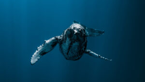
Their work will focus on detecting and mapping vulnerable deep-sea habitats such as coral reefs, sponge gardens and crinoid communities. These organisms are considered keystone species in the deep ocean, creating habitats that support a wide array of marine life in environments where sunlight cannot reach.

In other news

Deep-sea ecosystems also play an important role in global ocean processes, contributing to carbon storage and nutrient cycling that ultimately help sustain surface fisheries and regulate the climate.
According to Kerry Howell, Ocean Challenge Lead for Biodiversity Loss at Plymouth Marine Laboratory and project lead for Deep Vision, the initiative aims to fill major knowledge gaps about ecosystems in the High Seas.
“We are increasingly using our marine environment for economic gain and pushing into areas beyond national jurisdiction – the high seas – that we really don’t know much about. But how are we supposed to make decisions about the areas that are most important to protect if we don’t have maps of what we have and where it is?
“This project will harness cutting edge advances in big data and AI to help better protect a raft of species that play a vital, yet largely unseen, role in our ocean.”
The resulting maps are expected to provide environmental managers with critical scientific evidence to guide marine protection measures, particularly as countries move to implement the recently adopted High Seas Treaty.
At present, policymakers lack comprehensive information on where vulnerable deep-sea ecosystems occur, making it difficult to identify priority areas for new marine protected areas in international waters.
Deep Vision represents the first attempt to compile biodiversity data at the scale of an entire ocean basin. Once mapping of the Atlantic is complete, researchers hope the approach can be expanded to other regions of the world’s oceans.
“This is a unique project because no one has really tried to bring this huge amount of data together before for biodiversity at the scale of the Atlantic Ocean,” Prof Howell added. “It’s a big challenge, and AI is really the way to unlock it.”
The initiative will also prove to be something of a test case for how emerging technologies can accelerate global efforts in marine conservation. The project is supported by funding from the Bezos Earth Fund through its AI for Climate and Nature Grand Challenge.


"*" indicates required fields
Printed editions
Current issue
Back issues
Enjoy so much more from Oceanographic Magazine by becoming a subscriber.
A range of subscription options are available.